Description
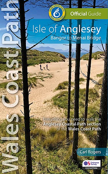
This NEW Official Guide to the Isle of Anglesey section of the Wales Coast Path describes the route in an anti- clockwise direction, starting and finishing at Menai Bridge.
New Edition – wholly rewalked and updated 2024
One of seven Official Guides to the Wales Coast Path
The Official Guide to the Isle of Anglesey section of the Wales Coast Path makes a complete circuit of the island from Menai Bridge on the mainland —offering approximately 200 kilometres/125 miles of superb coastal walking.
Anglesey is Wales’ largest island (approximately 48km/30 miles wide) and lies off the coast of North Wales. It is separated from the mainland by the Menai Strait—a narrow river-like channel 12 miles (20 kilometres) long and just 250 metres wide at its narrowest point. Despite this, Anglesey is every bit an island and has a character very different to that of the mainland. Geologically it is an extension of the narrow coastal plain that fringes the mountains and is composed of flat or gently undulating farmland. The island’s coastline, on the other hand, is both dramatic and varied, and those who visit the island with a view to exploring the coast will discover a stunningly beautiful landscape.
In fact Anglesey can boast some of the most varied coastal scenery in the British Isles. Within a ring of about 125 miles (200 kilometres) there are wide tidal estuaries, beautiful sandy bays, isolated coves, tiny villages and numerous off-shore rocks and islands. Anglesey also has one of the largest sand dune systems in the country, whilst other sections of the coast are as rugged and dramatic as anywhere in Britain and often far less crowded.
Unsurprisingly, 85 square miles adjoining the coast has been designated as one of Wales’ five Areas of Outstanding Natural Beauty (AONB). The plan of the island is roughly square and each of its four sides has a very different character. The south coast, for the most part, borders the Menai Strait and, being sheltered from the open sea, shows few signs of the coastal erosion so apparent elsewhere. It is almost Cheshire-like with its green fields, hedgerows and woods, which in places reach right down to the water’s edge—an unusual sight on the Welsh coast.
This stretch reaches its end at Penmon and immediately things change, although shelter from the prevailing wind is apparent in the lack of windsculptured trees and stunted bushes so characteristic of the west. The broad sweep of Red Wharf Bay is the main feature of this coastline, along with a number of small village resorts like Benllech and Moelfre. From Point Lynas the coast swings west into the Atlantic gales and things change dramatically. Just two small villages cling to this battered coastline which has been fragmented into a scattering of off-shore islets. The most dramatic cliff scenery is to be found on the west coast; both on the northwest tip of the island between Carmel Head and Church Bay, and on Holy Island at Gogarth and Rhoscolyn. On the southwest tip of the island lower elevations have resulted in substantial sand dune systems rather than cliff scenery—Aberffraw and Newborough Warren being the most notable. Newborough has one of the largest dune systems in the country and is now a national nature reserve.
The guide divides the path into twelve day-walk sections, each of about 9-12 miles / 14-20 kilometres. Each Day Section starts and finishes at or close to somewhere attractive and accessible with good facilities.
It contains everything local and long-distance walkers need to enjoy the path.
- An overview of the Isle of Anglesey section of the Wales Coast Path with dedicated history and wildlife sections
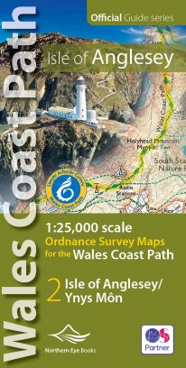
- Twelve day-walk sections with detailed route descriptions and full, enhanced Ordnance Survey mapping
- Distance charts, section overviews, background information and interpretation of places of interest
- Stunning professional photographs throughout
- Information on accommodation, public transport, local information, weather, and tidal links.
Contents
Wales Coast Path: Discover the shape of a nation
Wales Coast Path: An 870-mile coastal adventure
The Best of the North Wales coast
North Wales Coast: Part of the Wales Coast Path
Walking the North Wales coast – map and distance chart
Day Sections
Limited for time? – the Isle of Anglesey in a nutshell
A brief history of the Isle of Anglesey
Wildlife on the Isle of Anglesey
Wildfowl, waders and wild ponies
The Isle of Anglesey section of the Wales Coast Path
Day Section 1: Bangor to Beaumaris
Day Section 2: Beaumaris to Pentraeth
Day Section 3: Pentraeth to Moelfre
Day Section 4: Moelfre to Amlwch Port
The ‘Golden Wreck’
Day Section 5: Amlwch to Cemaes Bay
Day Section 6: Cemaes Bay to Church Bay
Rocks, Reefs and Shipwrecks
Day Section 7: Church Bay to Holyhead
Day Section 8: Holyhead to Trearddur
Day Section 9: Trearddur to Four-mile Bridge
Day Section 10: Four-mile Bridge to Aberffraw
Sacrificial Lake?
Day Section 11: Aberffraw to Newborough
Lovers’ Island
Day Section 12: Newborough to Menai Bridge
Menai Strait
Welsh Coastal Place Names
Useful Information
What they say …
“These excellent guides lay the whole Wales Coast Path at your feet — mixing practical information with the history, heritage and wildlife you will meet as you walk.”
— Country Walking magazine

Reviews
There are no reviews yet.