-
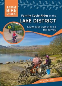 by Alf Alderson As one of the UK’s most beautiful regions it’s no surprise that the Lake Districtis so popular amongst cyclists. It also has a fearsome reputation — climbs such as Honister Pass and Whinlatter Pass are challenging enough to have featured in the Tour of Britain, whilst the grueling combination of Hardknott and Wrynose Passes between Little Langdale and Eskdale offers some of the toughest cycling in the country, with 33 per cent gradients in some places. But the Lake District is not all super-steep hills, fortunately! There are plenty of easy lakeside cycle paths and quiet country lanes, along with the mountain bike centres at Whinlatter and Grizedale, where even the youngest cycling enthusiast can get to know this beautiful landscape. So with a little effort, anyone can access some truly magnificent Cumbrian scenery on their bike
 -

Wales: Cadair Idris - Neck Gaiter/Scarf/Snood
Wearable large-scale 1:25,000 Ordnance Survey map artwork: Cadair Idris in Snowdonia
CADAIR IDRIS IS THE SECOND-HIGHEST MOUNTAIN IN THE SNOWDONIA NATIONAL PARK. Rightly popular with walkers, it stands at the southern end of the National Park near Dolgellau. This detailed Ordnance Survey mapping snood shows the shapely mountain and its three main routes of ascent, making it the ideal present or souvenir for everyone who has climbed, or dreams of climbing, this wonderful summit. Note: While the Ordnance Survey mapping used on the snood is up-to-date at the time of production, it is not recommended for navigation. Walkers should carry the correct OS online or sheet map and compass.Ordnance Survey Licence No.: 0100047867
-
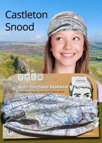
Peak District: Castleton - Neck Gaiter/Scarf/Snood
Wearable large-scale 1:25,000 Ordnance Survey map artwork: Castleton in the Peak District
CASTLETON AND THE GREAT RIDGE LIE AT THE HEART OF THE PEAK DISTRICT. This attractive, silky smooth snood features historic coloured map artwork showing the area in detail. The perfect souvenir or gift. Note: While the Ordnance Survey mapping used on the snood is up-to-date at the time of production, it is not recommended for navigation. Walkers should carry the correct OS online or sheet map and compass.Ordnance Survey Licence No.: 0100047867
-
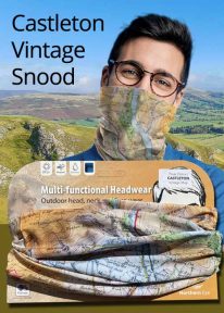
Peak District: Castleton (Vintage) - Neck Gaiter/Scarf/Snood
Wearable large-scale historic map artwork: Castleton in the Peak District
CASTLETON AND THE GREAT RIDGE LIE AT THE HEART OF THE PEAK DISTRICT NATIONAL PARK. The ever-popular town lies between the gentle limestone 'White Peak' to the south, and the starker gritstone 'Dark Peak' to the north. This attractive, silky smooth snood features historic coloured map artwork showing the area in detail. Note: The historic mapping used on this snood is not recommended for navigation. Walkers should carry the correct modern OS online or sheet map and compass. -
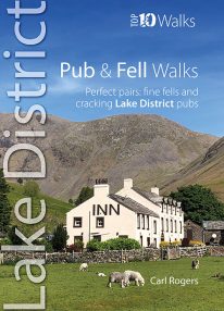 If you like walking up Lakeland's most iconic fells followed by a visit to an excellent and nearby pub or inn, then this is the book for you. Well-known outdoor author Carl Rogers cleverly combines some of Cumbria's finest fell walks with its best-loved pubs. They're a marriage made in heaven — with some super natural pairs such as the Kirkstile Inn at Loweswater with Melbreak literally just behind the pub. Up a fell and down a pint - what could be better?