-

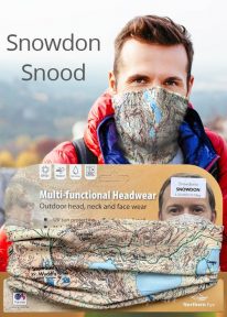
Snowdon - Neck Gaiter/Scarf/Snood
Wearable large-scale 1:25,000 Ordnance Survey map artwork: Snowdon in Snowdonia
SNOWDON IS THE HIGHEST AND MOST POPULAR MOUNTAIN IN WALES. Also known as 'The Top of Wales', it reaches 1,085 metres (3,560 ft) above sea level. This detailed Ordnance Survey mapping snood shows the summit and six main routes of ascent, making it the ideal present or souvenir for everyone who reaches, or dreams of reaching, the top Note: While the Ordnance Survey mapping used on the snood is up-to-date at the time of production, it is not recommended for navigation. Walkers should carry the correct OS online or sheet map and compass.Ordnance Survey Licence No.: 0100047867
-
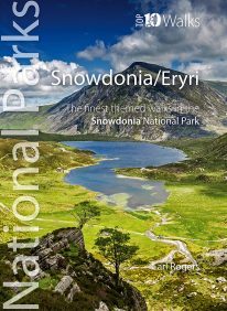
 Discover the very best of the dramatic Snowdonia National Park, in North Wales. These ten themed walks will take you to the best and most iconic places across Snowdonia, from the mighty Aber Falls in the north, to Cadair Idris, in the south. Famous for its lofty mountains and open hills, Snowdonia is characterised, too, by dramatic upland lakes and tarns enfolded within glacial troughs and valleys, and short, steep rivers tumbling to the sea. Discover vast empty beaches, friendly pubs and stunning views, hidden lakes and awesome waterfalls, challenging hills and mighty mountains. Every one is a walk to enjoy and savour on the day, and to remember long afterwards.

