- Ben Lomond (Ptarmigan Ridge),
- Ben Donich,
- The Cobbler,
- Ben Vorlich,
- An Caisteal,
- Cruach Ardrain,
- Beinn Odhar,
- Stob Binnein,
- Ben Venue
- Ben Ledi
-
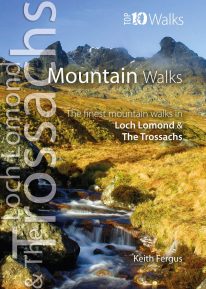 WITH MORE THAN FORTY MOUNTAINS over 2,500 feet spread across the Loch Lomond and The Trossachs National Park, it is tricky to choose just ten favourites. This careful selection aims to illustrate the rich diversity of mountain walks within the National Park. Classic Munros such as Ben Lomond and Stob Binnein are all visited, while other peaks are combined with near neighbours to provide more challenging walks. Enjoy the ten best circular walks exploring the mountains and beinns of the lovely Loch Lomond and The Trossachs National Park. Featured walks include:
 -
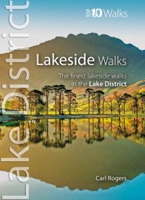 This popular pocket size book will take you on ten short circular walks to the finest lakeside paths in the Lake District. Lakeland’s characteristic lakes and meres are a legacy of the last Ice Age when vast ice sheets scoured out deep U-shaped valleys and upland combes. Today, sixteen main lakes and scores of smaller tarns punctuate the National Park. They include England’s longest lake (Windermere: 10½ miles long), and its deepest lake (Wast Water: 243 feet deep). Only Windermere, Derwent Water, Coniston Water and Ullswater have regular steamer and ferry services, yet every lake features dramatic waterside walks that will stay in your memory forever.
 -
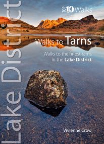 This smashing little book features ten short circular walks to the loveliest tarns in the Lake District. Norsemen, who dominated Lakeland 1,000 years ago, called the small bodies of water they found in the mountains tjorns—‘little lakes’ or , literally, ‘teardrops’. Now known as tarns, they are remnants of the last Ice Age when huge ice sheets scoured out hollows in the mountains that then filled with water. There are hundreds of tarns in the Lake District National Park: from tiny pools sparkling like blue jewels on high, lonely ridge tops, to small lakes sitting cold and moody at the base of sombre cliffs.
 -
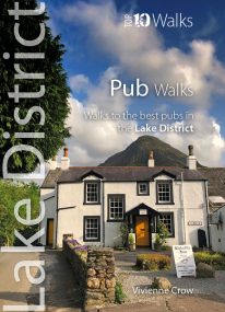 Here in one pocket size book are ten, easy, short circular walks to the finest Lake District pubs. The words ‘Lakeland’ and ‘pub’ go together like ‘bread’ and ‘butter’ or ‘Romeo’ and ‘Juliet’. The Lake District is a region that’s famed for its traditional inns and cosy, friendly village pubs almost as much as it’s famed for its magnificent walking country. So, what could be better than combining the two—enjoying a pint of local ale half-way through a gorgeous Sunday stroll, or a hearty meal at the end of a day’s hiking?
 -
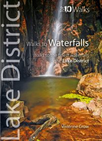 WINNER OF THE OUTDOOR WRITERS AND PHOTOGRAPHERS’ GUILD’S ‘BEST GUIDEBOOK’ AWARD 2013 This attractive pocket size book features ten easy, short circular walks to the most amazing Lake District waterfalls. The dramatic waterfalls of the Lake District are mostly a by-product of the last Ice Age — the awesome result of the ancient interplay of ice and rock. Given perpetual life by the region’s high rainfall, they come thundering down from the fells in a variety of forms. No two are the same. Many carry the name ‘force’—from the old Norse foss simply meaning ‘waterfall’—a remnant of the times when Norsemen dominated these uplands. Unmissable!
 -
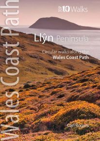 This handy little guide book gives you the ten very best short circular walks along the Llŷn peninsula section of the Wales Coast Path The Llŷn pushes 30 miles into the Irish Sea, tipped by the holy isle of Bardsey, or Ynys Enlli — ‘the island of 20,000 saints’. This remote and unspoilt landscape is characterised by traditional farms and compact villages, punctuated by volcanic hills. Its relative isolation has made it a haven for the Welsh language and culture. Sea cliffs, offshore rocks and intimate coves dominate the northern coast, while the gentler southern coast promises sandy beaches and holiday towns like Abersoch and Pwllheli. But for sheer beauty, tranquillity and wildlife, the Llŷn is hard to beat.
 -
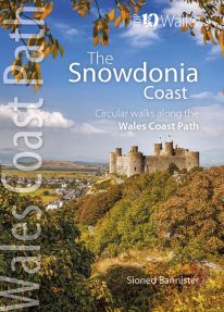 This lovely little book contains the ten best short circular walks along the north part of the Cardigan Bay section of the Wales Coast Path Cardigan Bay embraces the dramatic sweep of the Welsh coastline, from Bardsey island on the tip of Lleyn, in the north, to Strumble Head in Pembrokeshire, in the south. It takes in parts of two National Parks: Snowdonia and Pembrokeshire, and three different counties, Gwynedd, Ceredigion and Pembrokeshire. The striking northern section between Porthmadog and Borth is as varied as it is beautiful. Characterised by vast beaches and rugged cliffs, the coast offers superb walking with ever-changing views and a wealth of wildlife.
 -
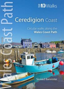 This handy pocket size book will take you on ten of the best short circular walks along the Ceredigion coast. Cardigan Bay embraces the dramatic sweep of the Welsh coastline, from Bardsey Island on the tip of the Llŷn in the north, to Strumble Head in Pembrokeshire in the south. It takes in parts of two National Parks: Snowdonia and Pembrokeshire, and three different counties: Gwynedd, Ceredigion and Pembrokeshire. The southern half of Cardigan Bay covers the rugged coastline between Aberystwyth and Cardigan. The dramatic cliffs and hidden coves are part of the Ceredigion Coast Path: a 60 mile trail that promises stunning views and some of the best opportunities for walkers to spot maritime wildlife in Wales.
 -
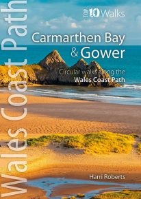 This handy, pocket size book will take you on the ten best short circular walks along the Carmarthen Bay and Gower stretch of the Wales Coast Path. Carmarthen Bay embraces an area of Welsh coast stretching from south Pembrokeshire to the Gower Peninsula. Long, sandy beaches and wide, silty estuaries dominate much of the bay, though there are also high cliffs and rocky coves in places. The Gower Peninsula, at the eastern end of the bay, is a small but priceless gem. Britain’s first official Area of Outstanding Natural Beauty (AONB), the peninsula contains an astonishing variety of landscapes: dunes, marshland, high cliffs, windswept downs, wooded valleys, picturesque villages and glorious sandy beaches — all linked by a superb footpath network.
 -
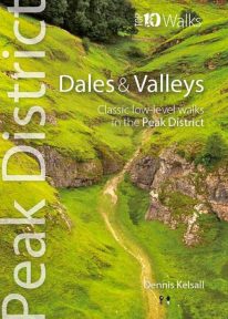 This attractive pocket size book gives you the ten very best dale and valley walks in the Peak District. The White Peak is known for dramatic limestone gorges: convoluted pathways carved into its heart, where rearing pinnacles, dark caves and thundering rivers struck awe into seventeenth-century travellers. Still captivating today, they harbour rich woodland, wildflower meadows and disappearing and resurgent streams, one of the area’s strangest curiosities. Delightful Dovedale, once the haunt of the renowned anglers Izaak Walton and Charles Cotton, contrasts with Cave Dale, a gaunt, dry passage below Castleton’s Norman stronghold. But the Dark Peak has attractive valleys too, and different again is the Dane Valley, which cuts onto the Cheshire Plain from the gritstone moors.
 -
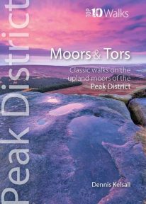 This lovely, pocket size book offers the ten best short circular walks to upland moors and tors across the Peak District. The uplands of the Peak bear the characteristics of hills rather than mountains: high, undulating plateaux dissected by deep, meandering valleys. Yet there is little uniformity; the seemingly remote moorland of the Kinder plateau is in sharp contrast to the gentler and lower upland heaths found farther south. These landscapes change subtly with the seasons and, for those who care to look, are rich in wildlife. There are birds, hares, and foxes; and in summer, adders and lizards bask in the sun while butterflies dance in the remotest places.
 -
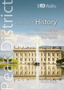 This lovely pocket size book explores ten of the Peak District's most fascinating historic landscapes — from prehistoric monuments to Industrial Revolution ruins. Stone tools from Thor’s Cave indicate that man arrived in the Peak as the glaciers receded. More obvious are Bronze and Iron Age circles, burials and earthworks, as well as the scars of mineral extraction — begun by the Romans and continuing today. Some Peakland churches claim Saxon foundation, and by the Middle Ages there was an extensive network of tracks and settlements. Water powered the first industrial revolution, bringing roads, canals and railways, and in the fine country mansions, farmsteads, cottages and town houses there is a rich variety of vernacular and classic architecture.