-
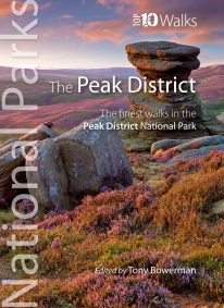 Discover the very best of the Peak District. These ten themed walks explore the contrasting faces of the Peaks — the gentle White and rugged Dark Peak. Discover clear rivers and streams, ancient packhorse bridges and stepping stones. Walk through winding dales and valleys bright with wildflowers. Visit stately Chatsworth or marvel at the panorama from Monsal Head. Tour upland reservoirs and dramatic rocky edges popular with climbers. Slog up Shutlingsloe or explore the open moorland and strangely eroded tors on Kinder Edge. Every one is a walk to remember.
 -
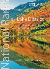 Discover the very best of the Lake District. Part of the Lake District’s unique attraction is its compactness. Within its boundaries are a rich mix of lakes, mountains, forests and farmland characterised by pretty villages, winding roads, deep dales and valleys, drystone walls and distinctive Herdwick and Swaledale sheep. Ready to explore? Discover the two loveliest lakeside walks, the best pub walk, and the most amazing view. Visit Cumbria’s stunning Castlerigg stone circle, scale its best-loved low and high fells, or marvel at its most dramatic waterfall. Every one is a walk to remember.
 -
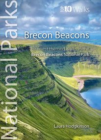 by Laura Hodgkinson This good looking, modern walking book will take you on ten short circular themed walks across South Wales' ever-popular Brecon Beacons National Park. The Brecon Beacons was Britain’s 10th National Park, established in 1957 to preserve and highlight the unique landscape of the area. The Brecon Beacons are said to be named after the historical practice of lighting beacons of fire upon hilltops to forewarn neighbouring valleys of invasion. The Brecon Beacons cover 1,344 square kilometres / 519 square miles with it’s spectacular waterfalls, valleys and expanse of hilly terrain; the Black Mountain to the west, the Fforest Fawr Geopark, Waterfall Country and the Pen y Fan range at the centre, and The Black Mountains to the east. The variety of flora and fauna is as vast as the landscape. Rare sub-arctic, alpine plants thrive within this unique climate. Mammals you're likely to spot include include wild mountain ponies, horseshoe bats, otters and water voles. Often seen birds of prey include the buzzard and iconic red kite. It's a wonderful area for walking and for everyone with a love of the outdoors.
 -
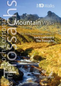 WITH MORE THAN FORTY MOUNTAINS over 2,500 feet spread across the Loch Lomond and The Trossachs National Park, it is tricky to choose just ten favourites. This careful selection aims to illustrate the rich diversity of mountain walks within the National Park. Classic Munros such as Ben Lomond and Stob Binnein are all visited, while other peaks are combined with near neighbours to provide more challenging walks. Enjoy the ten best circular walks exploring the mountains and beinns of the lovely Loch Lomond and The Trossachs National Park. Featured walks include:
- Ben Lomond (Ptarmigan Ridge),
- Ben Donich,
- The Cobbler,
- Ben Vorlich,
- An Caisteal,
- Cruach Ardrain,
- Beinn Odhar,
- Stob Binnein,
- Ben Venue
- Ben Ledi
-
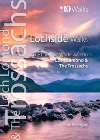 The ten best circular walks exploring the area’s seawater and freshwater lochs and lochans, including lochs Lomond, Katrine, and Venachar. Stunning scenery and unusual wildlife. Featured walks include: Luss, Balloch Castle Country Park, Loch Lomond NNR, Balmaha & Milarrochy, Sallochy Wood & Dun Maoil, Along Loch Katrine, Loch Ard, Loch Katrine & Loch Arklet, Inversnaid & Loch Lomond and Loch Venachar.
 -
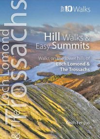 The ten best circular hill walks in the area. Classic easy summits include Conic Hill, Duncryne and Ben A’an. Perfect panoramas, breathtaking views and a wealth of wildlife.
 -
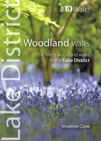 This lovely little book will take you on ten short circular walks through the finest woods and forests in the Lake District People seem to be drawn to trees, be they part of a landscape that has existed for centuries or planted in more modern times. There is something special about being in among their sturdy trunks, surrounded by a rich understorey with the sunlight piercing the canopy high above. In the Lake District, there is a huge variety of woodland — and no matter what their origins, what tree types grow there or how they have been managed, that extraordinary atmosphere never fails to nourish the soul.
 -
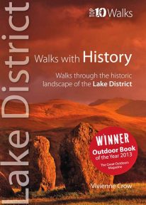 WINNER OF TGO’s ‘BEST GUIDEBOOK’ AWARD 2013 This award-winning book of short circular walks explores the ten most amazing historic sites in the Lake District. It may not seem obvious at first, but the rich human heritage of the area we now call the Lake District is evident all around us as we walk the fells and dales. From the enigmatic monuments built by prehistoric peoples to the industrial scars left in more modern times, centuries of human habitation have left their mark on this landscape. Keep your eyes and your imagination open, and you will come to realise that every step you take is a step through time. A worthy winner.
 -
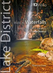 WINNER OF THE OUTDOOR WRITERS AND PHOTOGRAPHERS’ GUILD’S ‘BEST GUIDEBOOK’ AWARD 2013 This attractive pocket size book features ten easy, short circular walks to the most amazing Lake District waterfalls. The dramatic waterfalls of the Lake District are mostly a by-product of the last Ice Age — the awesome result of the ancient interplay of ice and rock. Given perpetual life by the region’s high rainfall, they come thundering down from the fells in a variety of forms. No two are the same. Many carry the name ‘force’—from the old Norse foss simply meaning ‘waterfall’—a remnant of the times when Norsemen dominated these uplands. Unmissable!
 -
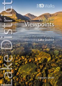 When it comes to hill walking, walks with views are much more fun than those without. These walks will also take keen photographers to come of the best places in Cumbria for taking those stunning images. Viewpoints are the walkers reward: the potential grandeur of the vista or panorama from just over the next incline or the atop the next crag is the incentive that draws on weary legs to summits. With lakes, rivers, forests, woodland, rolling countryside and craggy fells all crammed into such a compact geographical area, it’s no surprise that the Lake District is full of such stunning visual rewards, with unique and beautiful views around every corner.
 -
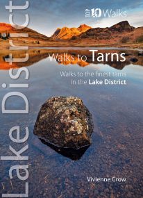 This smashing little book features ten short circular walks to the loveliest tarns in the Lake District. Norsemen, who dominated Lakeland 1,000 years ago, called the small bodies of water they found in the mountains tjorns—‘little lakes’ or , literally, ‘teardrops’. Now known as tarns, they are remnants of the last Ice Age when huge ice sheets scoured out hollows in the mountains that then filled with water. There are hundreds of tarns in the Lake District National Park: from tiny pools sparkling like blue jewels on high, lonely ridge tops, to small lakes sitting cold and moody at the base of sombre cliffs.
 -
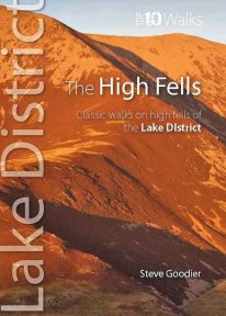 This handy, pocket size book explores ten short circular routes on the best high fells in the Lake District. The Lakeland fells have inspired writers, artists and walkers for centuries. Like the deep valleys that separate them, they were formed by the flow and grind of ancient ice sheets. Above the 2,000-foot contour, they form a high mountain environment whose sheer cliffs, narrow edges, and exposed rocky summits demand respect. Today, this rugged upland landscape is one of the most visited hill walking areas in Britain. The high fells feature enough classic routes, challenges and captivating views to delight even the most demanding fell walker.
 -
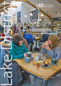 A visit to a tea shop adds something special to a walk. It’s always a treat to sit down to coffee and cake at the end of an afternoon stroll or to tuck into a hearty lunch half-way through a gorgeous hike. From quaint little tea rooms that still serve drinks in china cups to modern cafés staffed by trained baristas, the Lake District has plenty to offer — and all surrounded by a truly breathtaking UNESCO World Heritage landscape. The ten tea shops in this book have been chosen partly on the basis of the excellent walking that can be enjoyed from their doors, and partly on the basis of the fare and ambience they have to offer. They occupy village, lakeside and woodland locations. The walks themselves take in hidden valleys, low fells, lakes, waterfalls, riverside paths, fabulous viewpoints and wildflower-filled woods — a tremendous array of the sort of scenery for which the Lake District has become world famous.
 -
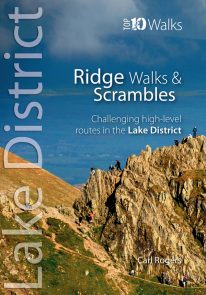 The Lakeland Fells have some of the finest ridge walks in the country. Exploring these ridges offers fell walking at its most satisfying — staying high, taking in several summits and enjoying the spectacular settings. Many of the Lake District’s ridge walks have become classics, like the grassy edges of the Fairfield and Kentmere Horseshoes, or rocky aretes of Striding Edge and Swirral Edge and the aptly named Sharp Edge of Blencathra.
 -
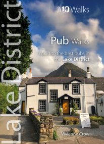 Here in one pocket size book are ten, easy, short circular walks to the finest Lake District pubs. The words ‘Lakeland’ and ‘pub’ go together like ‘bread’ and ‘butter’ or ‘Romeo’ and ‘Juliet’. The Lake District is a region that’s famed for its traditional inns and cosy, friendly village pubs almost as much as it’s famed for its magnificent walking country. So, what could be better than combining the two—enjoying a pint of local ale half-way through a gorgeous Sunday stroll, or a hearty meal at the end of a day’s hiking?
 -
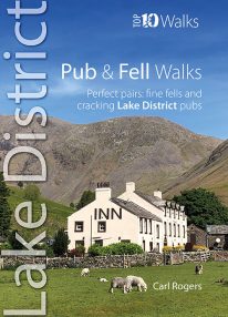 If you like walking up Lakeland's most iconic fells followed by a visit to an excellent and nearby pub or inn, then this is the book for you. Well-known outdoor author Carl Rogers cleverly combines some of Cumbria's finest fell walks with its best-loved pubs. They're a marriage made in heaven — with some super natural pairs such as the Kirkstile Inn at Loweswater with Melbreak literally just behind the pub. Up a fell and down a pint - what could be better?
 -
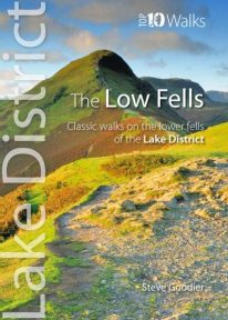 This superb pocket size book will take you on ten short circular walks to the ten best-known low fells in the Lake District The fells get their name from the Old Norse word, fjalls, which originally meant areas of rough upland grazing. Today, the Lakeland fells promise some of the best high level walking in England, and a real sense of freedom. But though the high fells often feature rocky summits, narrow edges and sheer cliffs, the lower fells, below the 2,000 foot contour, are greener, rounder and kinder. Walking on them can still be steep and strenuous, of course, but the routes are more suitable for the general walker. And the views are just as incredible.
 -
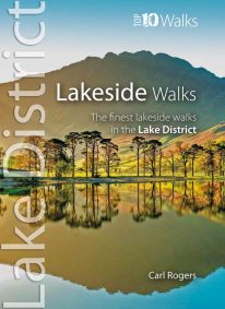 This popular pocket size book will take you on ten short circular walks to the finest lakeside paths in the Lake District. Lakeland’s characteristic lakes and meres are a legacy of the last Ice Age when vast ice sheets scoured out deep U-shaped valleys and upland combes. Today, sixteen main lakes and scores of smaller tarns punctuate the National Park. They include England’s longest lake (Windermere: 10½ miles long), and its deepest lake (Wast Water: 243 feet deep). Only Windermere, Derwent Water, Coniston Water and Ullswater have regular steamer and ferry services, yet every lake features dramatic waterside walks that will stay in your memory forever.
 -
 by Vivienne Crow This exciting, new and interactive guide brings families with children ten of the very best family adventures in the Lake District National Park. With expertly-chosen adventures, superb photographs, clear information, an overview and introduction for each walk, expertly written numbered directions, large scale maps, and four themed interactive challenges for every adventure, these guides set a new standard in design, concept, clarity and ease-of-use.
 -
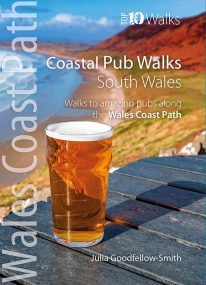
South Wales' best coastal pub walks
This pocket-sized guide gives walkers ten easy, circular walks to amazing coastal pubs along the South Wales section of the Wales Coast Path. With clear information, an overview and introduction for each walk, expertly written numbered directions, large scale Ordnance Survey maps, superb eye-grabbing panoramic photographs, and interpretation of points of interest along the way, these guides set a new standard in clarity and ease-of-use. Each of the short circular walks has been selected for both the quality of the pub and the walk itself. The routes cover the very best walking country in the area. All are in landscapes with particular historical or wildlife interest, and all follow part of the Wales Coast Path. -
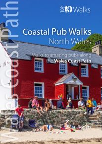
North Wales' best coastal pub walks
The comfortable, friendly and often upmarket pubs along the North Wales coast complement the walking on this superb stretch of the Wales Coast Path. Each walk incorporates a section of the Wales Coast Path, and starts and finishes close to a great, carefully selected pub. Combined, they cover the very best stretches of North Wales' coastline, one of striking contrasts and wonderful surprises. The easy, circular pub walks take in the North Wales Coast between Chester and Caernarfon, the Isle of Anglesey, and the remote Llyn peninsula. All the pubs are situated either right on the coast or a short hop inland — some in coves and harbours, some in the dunes or close to clifftops, others almost on the sand — and the majority are open all day. With the pubs often open all year and the walking good in all seasons, the North Wales Coast, Anglesey and the Llyn are quite rightly a year-round destination. -
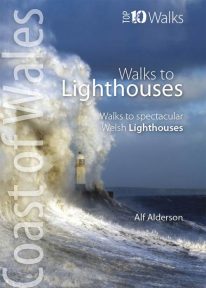 The ten walks featured here highlight the very best Welsh lighthouses and huge variety of the coastline of Wales. From vast expanses of sand, sea and sky, such as at Whiteford Point and Llanddwyn Island, to rugged coastline where seabirds wheel and skrike and porpoise and seals slide through the waves, like Strumble Head and South Stack, these walks to lighthouses guarantee a fine day out. All are circular, and vary from short and easy, like the to Talacre lighthouse, to longer and more demanding, such as that to St. Ann’s Head lighthouse — but none are beyond any reasonably fit and enthusiastic walker.
 -
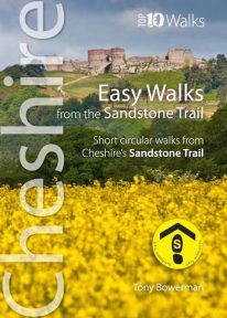 Cheshire’s Sandstone Trail is probably the most popular middle-distance walk in Northwest England. The Trail runs for 55 kilometres/34 miles along Cheshire’s beautiful and varied central sandstone ridge between Frodsham and Whitchurch, just over the border in Shropshire. This cleverly structured and well designed guidebook gives walkers the ten best short circular walks along the length of the Sandstone Trail in a handy, pocketable format.
 -
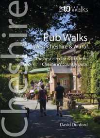 This handy, wonderfully illustrated little guidebook gives walkers the ten best short circular walks to some of the very best country pubs and inns in Cheshire and Wirral in a handy, pocketable format. As befits a well-heeled, fertile county with a rich farming heritage, the country pubs and inns of Cheshire and Wirral are hugely rewarding to visitors and walkers. From numerous candidates we’ve whittled the list down to personal favourites that balance a lack of pretention with good service, and are also blessed with pleasant locations and rewarding walks from the doorstep, while attempting a representative geographical distribution covering the range of landscapes of this diverse county.
 -
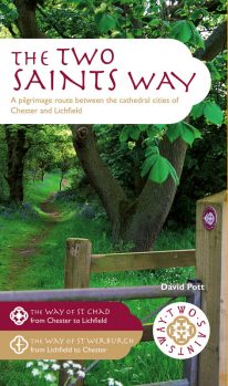 An impressive guide book that coincides with the growing interest in pilgrimage as an aspect of ‘wellness’ tourism that benefits body, mind and spirit. The guide is packed with information both practical and historical. It is an attractive publication with OS map extracts and numerous high quality colour photos. The Two Saints Way has a symmetrical structure with the two cathedrals at either end, Stoke Minster in the middle and two churches dedicated to St Mary at the quarter points. With this in mind, the 92 mile route is divided into four colour coded sections - 1: Chester to Nantwich, 2: Nantwich to Stoke, 3: Stoke to Stafford and 4: Stafford to Lichfield. Each section is further divided into four stages of between 3.5 and 8.5 miles in length. The route is described in both directions. Highlights on this varied route include Beeston Castle, Englelsea Brook Chapel and Museum, the Staffordshire Hoard at the Potteries Museum, Trentham Gardens and Cannock Chase Area of outstanding Natural Beauty. The guide contains a wealth of fascinating information on many features of interest.
 -
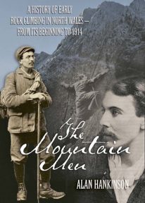 The fascinating inside story of pioneer rock climbers in Snowdonia, from the closing decades of the nineteenth century until the outbreak of the First World War.
 -
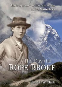 This book is a climbing classic. Hardback. The Day the Rope Broke is the gripping tale of the ascent and tragic descent of the Matterhorn in 1865.
 -
 If you've ever climbed Snowdon/Yr Wyddfa (or even just dream of climbing Snowdon) - Wales' highest mountain - then this stylish, superb quality sew-on embroidered patch makes a great souvenir, keepsake or gift.
- Eye-catching, modern design
- Full colour
- Embroidered
- 80mm high
- Contrasting stitched edge
- Colourfast and washable
- Designed in Wales
-
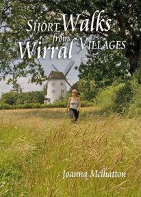 The 30 short circular walks in this book have been written with the non-serious walker in mind, varying in length from just 1 to 4¾ miles (1.5km to 7.5km). Each walk has something of interest to discover — you will visit the site of an ancient port now completely dried out and over a mile inland; a seafront with neither sand nor sea; a wild, wooded river valley in the heart of industrial Merseyside and a lowland heath with wide views to the Welsh hills
 -
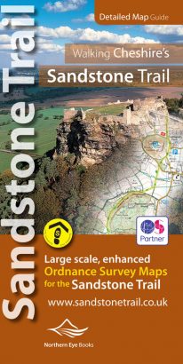
Large-scale Ordnance Survey maps for walking Cheshire's Sandstone Trail in a handy pocket size book.
Cheshire’s Sandstone Trail is probably the most popular middle-distance walk in Northwest England. Here, in handy, pocket size book format are all the maps you need to walk Cheshire's entire 55 kilometre/34 mile Trail.- Enlarged and enhanced, large scale 1:25,000 Ordnance Survey mapping for the whole Sandstone Trail
- Up-to-date route of Sandstone Trail clearly highlighted in yellow
- Extra map symbols for pubs, tea rooms, parking and more
- Trail introduction and photo mosaic
- Useful information section
- Ideal for walkers and all outdoor enthusiasts along Cheshire's sandstone ridge
- Contains relevant mapping from two OS maps for the price of one
-
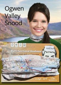
Wales: Tryfan & the Glyders - Neck Gaiter/Scarf/Snood
Wearable large-scale 1:25,000 Ordnance Survey map artwork: Tryfan & the Glyders in Snowdonia
WALES' FAMOUS OGWEN VALLEY is home to the shallow, ribbon lake of Llyn Ogwen (alongside the main A5) , which divides the two main mountain rages of the Snowdonia National Park — the Carneddau and the Glyderau. Key mountains here include mighty Tryfan and the Glyders. This detailed Ordnance Survey mapping snood shows the lake and its dramatic surroundings, making it the ideal present or souvenir for everyone who loves this iconic valley and its surrounding peaks. Note: While the Ordnance Survey mapping used on the snood is up-to-date at the time of production, it is not recommended for navigation. Walkers should carry the correct OS online or sheet map and compass.Ordnance Survey Licence No.: 0100047867
-

Wales: Cadair Idris - Neck Gaiter/Scarf/Snood
Wearable large-scale 1:25,000 Ordnance Survey map artwork: Cadair Idris in Snowdonia
CADAIR IDRIS IS THE SECOND-HIGHEST MOUNTAIN IN THE SNOWDONIA NATIONAL PARK. Rightly popular with walkers, it stands at the southern end of the National Park near Dolgellau. This detailed Ordnance Survey mapping snood shows the shapely mountain and its three main routes of ascent, making it the ideal present or souvenir for everyone who has climbed, or dreams of climbing, this wonderful summit. Note: While the Ordnance Survey mapping used on the snood is up-to-date at the time of production, it is not recommended for navigation. Walkers should carry the correct OS online or sheet map and compass.Ordnance Survey Licence No.: 0100047867
-
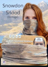
Snowdon - Neck Gaiter/Scarf/Snood
Wearable large-scale historic (1912) map artwork: Snowdon in Snowdonia
SOMETIMES CALLED 'THE TOP OF WALES', Snowdon is the highest and best-known peak in the country, reaching 1,085 metres (3,560 ft) above sea level. This historic, 1912 Ordnance Survey map snood shows the summit and all six main paths up, making it the ideal gift or souvenir for mountain fans everywhere. Note: The historic mapping used on this snood is not recommended for navigation. Walkers should carry the correct modern OS online or sheet map and a compass. -

Snowdon - Neck Gaiter/Scarf/Snood
Wearable large-scale 1:25,000 Ordnance Survey map artwork: Snowdon in Snowdonia
SNOWDON IS THE HIGHEST AND MOST POPULAR MOUNTAIN IN WALES. Also known as 'The Top of Wales', it reaches 1,085 metres (3,560 ft) above sea level. This detailed Ordnance Survey mapping snood shows the summit and six main routes of ascent, making it the ideal present or souvenir for everyone who reaches, or dreams of reaching, the top Note: While the Ordnance Survey mapping used on the snood is up-to-date at the time of production, it is not recommended for navigation. Walkers should carry the correct OS online or sheet map and compass.Ordnance Survey Licence No.: 0100047867
-
Coming Soon

Scotland: Ben Nevis - Neck Gaiter/Scarf/Snood
Wearable large-scale 1:50,000 Ordnance Survey map artwork: Ben Nevis in Scotland
BEN NEVIS IS THE HIGHEST MOUNTAIN IN SCOTLAND AND THE BRITISH ISLES. Rising to 1,345 metres (4,413 ft) above sea level, the summit is reached by around 100,000 visitors a year. This detailed Ordnance Survey mapping snood shows the mountain and its awe-inspiring surroundings, making it the ideal present or souvenir for everyone who loves this most famous of Scotland's mountains. Note: While the Ordnance Survey mapping used on the snood is up-to-date at the time of production, it is not recommended for navigation. Walkers should carry the correct OS online or sheet map and compass.Ordnance Survey Licence No.: 0100047867
-
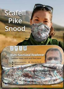
Scafell Pike - Neck Tube/Scarf/Snood
Wearable large-scale 1:25,000 Ordnance Survey map artwork: Scafell Pike in the Lake District
CELEBRATE ENGLAND'S HIGHEST MOUNTAIN and one of the National Three Peaks Challenge summits with this attractive modern Ordnance Survey 1:25,000 scale mapping snood or neck warmer. It looks great and will keep you snug and comfortable on the way up and down. The perfect gift or souvenir for everyone who climbs - or is about to climb - this iconic peak. Note: While the Ordnance Survey mapping used on the snood is up-to-date at the time of production, it is not recommended for navigation. Walkers should carry the correct OS online or sheet map and compass.Ordnance Survey Licence No.: 0100047867
-
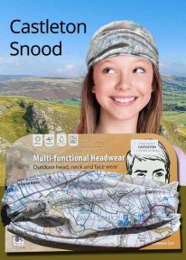
Peak District: Castleton - Neck Gaiter/Scarf/Snood
Wearable large-scale 1:25,000 Ordnance Survey map artwork: Castleton in the Peak District
CASTLETON AND THE GREAT RIDGE LIE AT THE HEART OF THE PEAK DISTRICT. This attractive, silky smooth snood features historic coloured map artwork showing the area in detail. The perfect souvenir or gift. Note: While the Ordnance Survey mapping used on the snood is up-to-date at the time of production, it is not recommended for navigation. Walkers should carry the correct OS online or sheet map and compass.Ordnance Survey Licence No.: 0100047867
-
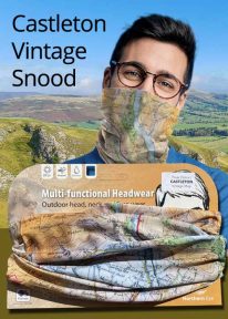
Peak District: Castleton (Vintage) - Neck Gaiter/Scarf/Snood
Wearable large-scale historic map artwork: Castleton in the Peak District
CASTLETON AND THE GREAT RIDGE LIE AT THE HEART OF THE PEAK DISTRICT NATIONAL PARK. The ever-popular town lies between the gentle limestone 'White Peak' to the south, and the starker gritstone 'Dark Peak' to the north. This attractive, silky smooth snood features historic coloured map artwork showing the area in detail. Note: The historic mapping used on this snood is not recommended for navigation. Walkers should carry the correct modern OS online or sheet map and compass. -
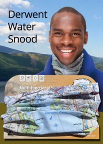
Lake District: Derwentwater - Neck Gaiter/Scarf/Snood
Wearable large-scale 1:25,000 Ordnance Survey map artwork: Derwentwater in the Lake District
DERWENT WATER IS ONE OF THE LAKE DISTRICT'S MOST POPULAR LAKES. Surrounded by fells, the island-dotted lake is three miles long and lies just to the south of Keswick. This luxurious, silky neck tube features wearable large-scale 1:25,000 Ordnance Survey map artwork of the lake and its beautiful shore. Now you or a friend can own this stylish and permanent souvenir of an iconic part of the English Lakes. Note: While the Ordnance Survey mapping used on the snood is up-to-date at the time of production, it is not recommended for navigation. Walkers should carry the correct OS online or sheet map and compass.Ordnance Survey Licence No.: 0100047867
-
Coming Soon
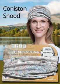
Lake District: Coniston - Neck Gaiter/Scarf/Snood
Wearable large-scale 1:25,000 Ordnance Survey map artwork: Coniston in the Lake District
CONISTON IS ONE OF THE LAKE DISTRICT'S LOVELIEST LAKES. Over five miles long and surrounded by the Cumbrian fells, Coniston is a justified favourite with visitors. The luxurious, silky neck tube features wearable large-scale 1:25,000 Ordnance Survey map artwork. Now you or a friend can own this stylish and permanent souvenir of an iconic part of the English Lake District. Note: While the Ordnance Survey mapping used on the snood is up-to-date at the time of production, it is not recommended for navigation. Walkers should carry the correct OS online or sheet map and compass.Ordnance Survey Licence No.: 0100047867
-
Coming Soon
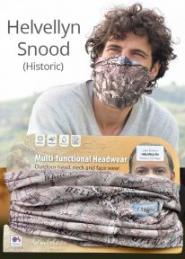
Helvellyn - Neck Gaiter/Scarf/Snood
Wearable large-scale historic map artwork: Helvellyn in the Lake District
HELVELLYN HAS BEEN A POPULAR CUMBRIAN SUMMIT FOR MANY YEARS. The snood's tightly woven material features a detailed historic colour map dating from 1912 — and shows the mountain in all its timeless beauty. A wonderful keepsake, gift or souvenir Note: The historic mapping used on this snood is not recommended for navigation. Walkers should carry the correct modern OS online or sheet map and compass. -

Helvellyn - Neck Gaiter/Scarf/Snood
Wearable large-scale 1:25,000 Ordnance Survey map artwork: Helvellyn in the Lake District
HELVELLYN IS ONE OF THE LAKE DISTRICT'S MOST POPULAR PEAKS at 950 metres / 3,118 feet above sea level. The luxurious, silky neck tube features wearable large-scale 1:25,000 Ordnance Survey map artwork. Now you or a friend can own this stylish and permanent souvenir of an iconic mountain. Note: While the Ordnance Survey mapping used on the snood is up-to-date at the time of production, it is not recommended for navigation. Walkers should carry the correct OS online or sheet map and compass.Ordnance Survey Licence No.: 0100047867
-
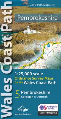 Enhanced, large scale (1: 25,000) Ordnance Survey mapping in a handy atlas format with all the mapping you need to walk a complete Pembrokeshire coast section of the Wales Coast Path. Continuous OS mapping covering the complete route from St Dogmael's near Cardigan to Amroth, on the Carmarthenshire border. Contains generous coastal extracts from large-scale OS Explorer maps OL 35 and OL36. The Pembrokeshire Coast Ordnance Survey mapping book is part of a series of map atlases covering the whole of the 870-mile long Wales Coast Path. The enhanced OS 1:25,000 maps are accurate, up-to-date and reliable. Additional map symbols show tea shops, cafes, extra parking, and public toilets. A brief introduction to the Pembrokeshire Coast includes a fascinating photo mosaic highlighting notable views, places of interest and wildlife you'll meet along the way. There is also a section of detailed Useful Information at the back of the atlas. Laminated flapped covers showing Wales Coast Path signs and waymarkers, route details and map symbols make these atlases simple and easy to use. The map books’ dimensions are 215mm x 107mm and they fit easily into a standard map pocket.
- Large scale Ordnance Survey Explorer mapping for the complete North Wales Coast in a handy atlas format.
- Highlighted official route of the Wales Coast Path.
- On-map symbols showing amenities at main towns and villages.
- Introduction with attractive photo mosaic.
- Additional useful information
-
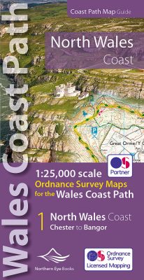 Enhanced, large scale (1: 25,000) Ordnance Survey mapping in a handy atlas format with all the mapping you need to walk a complete North Wales Coast section of the Wales Coast Path. Continuous OS mapping covering the complete route from Chester to Bangor, on the Menai Strait. Contains generous coastal extracts from large-scale OS Explorer maps 266, 265, 264 and OL17. The North Wales Coast Ordnance Survey mapping book is part of a series of map atlases covering the whole of the 870-mile long Wales Coast Path. The enhanced OS 1:25,000 maps are accurate, up-to-date and reliable. Additional map symbols show tea shops, cafes, extra parking, and public toilets. A brief introduction to the North Wales Coast includes a fascinating photo mosaic highlighting notable views, places of interest and wildlife you'll meet along the way. There is also a section of detailed Useful Information at the back of the atlas. Laminated flapped covers showing Wales Coast Path signs and waymarkers, route details and map symbols make these atlases simple and easy to use. The map books’ dimensions are 215mm x 107mm and they fit easily into a standard map pocket.
- Large scale Ordnance Survey Explorer mapping for the complete North Wales Coast in a handy atlas format.
- Highlighted official route of the Wales Coast Path.
- On-map symbols showing amenities at main towns and villages.
- Introduction with attractive photo mosaic.
- Additional useful information
-
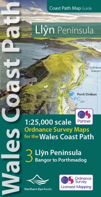 Enhanced, large scale (1: 25,000) Ordnance Survey mapping in a handy atlas format with all the mapping you need to walk a complete circuit of the Anglesey section of the Wales Coast Path. Continuous OS mapping covering the complete route from Bangor to Porthmadog. Contains coastal extracts from large scale Explorer maps 253 and 254. The Llyn Peninsula Ordnance Survey mapping book is part of a series of map atlases covering the whole of the 870-mile long Wales Coast Path. The enhanced OS 1:25,000 maps are accurate, up-to-date and reliable. Additional map symbols show tea shops, cafes, extra parking, and public toilets. A brief introduction to the Llyn Peninsula includes a fascinating photo mosaic highlighting notable views, places of interest and wildlife you'll meet along the way. There is also a section of detailed Useful Information at the back of the atlas. Laminated flapped covers showing Wales Coast Path signs and waymarkers, route details and map symbols make these atlases simple and easy to use. The map books’ dimensions are 215mm x 107mm and they fit easily into a standard map pocket.
- Large scale Ordnance Survey Explorer mapping for the complete coast of the Llyn Peninsula in a handy atlas format.
- Highlighted official route of the Wales Coast Path.
- On-map symbols showing amenities at main towns and villages.
- Introduction with attractive photo mosaic.
- Additional useful information
-
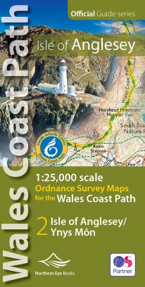 Enhanced, large scale (1: 25,000) Ordnance Survey mapping in a handy atlas format with all the mapping you need to walk a complete circuit of the Anglesey section of the Wales Coast Path. Continuous OS mapping covering the complete circuit from Menai Bridge. Contains coastal extracts from large scale Explorer maps 262 and 263. The Isle of Anglesey/Ynys Mon Ordnance Survey mapping book is part of a series of map atlases covering the whole of the 870-mile long Wales Coast Path. The enhanced OS 1:25,000 maps are accurate, up-to-date and reliable. Additional map symbols show tea shops, cafes, extra parking, and public toilets. A brief introduction to Anglesey includes a fascinating photo mosaic highlighting notable views, places of interest and wildlife you'll meet along the way. There is also a section of detailed Useful Information at the back of the atlas. Laminated flapped covers showing Wales Coast Path signs and waymarkers, route details and map symbols make these atlases simple and easy to use. The map books’ dimensions are 215mm x 107mm and they fit easily into a standard map pocket.
- Large scale Ordnance Survey Explorer mapping for the complete coast of the Isle of Anglesey/Ynys Mon in a handy atlas format.
- Highlighted official route of the Wales Coast Path.
- On-map symbols showing amenities at main towns and villages.
- Introduction with attractive photo mosaic.
- Additional useful information
-
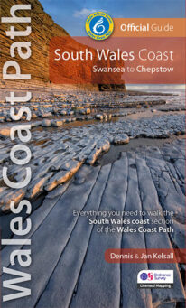 One of seven Official Guides to the Wales Coast Path The 115 mile/185km long South Wales Coast section of the Wales Coast Path runs through unexpectedly varied and dramatic coastal scenery. Along the way are four National Nature Reserves and some 14 miles of designated Heritage Coast, while the deserted salt marshes and mudflats bordering the later stages of the route alongside the mouth of the River Severn are a bird-watchers' paradise. This Official Guide splits the route into nine achievable day sections, each of about 10-17 miles / 16-27 kilometres. It contains everything local and long-distance walkers need to enjoy the path.
 -
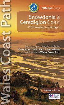 NEW, updated and revised edition – 2022 One of seven Official Guides to the Wales Coast Path The Snowdonia & Ceredigion coast offers a tremendous variety of landscape to those who walk its entire 132 miles/213 kilometres: from high, airy cliff-tops to secluded coves; from estuarine salt marshes to beaches backed by tremendous dune systems that stretch on for miles. And with that diversity comes a huge range of wildlife, including seabirds, choughs, dolphins and rare wildflowers. The history too changes with every twist and turn of this fascinating route: visitors should always be prepared for the unexpected in a region that contains the ruins of once mighty castles and has links with characters as disparate as King Arthur and members of the rock band Led Zeppelin.